
Geotechnical study in Mauricie
Trois-Rivières, Shawinigan, the MRC des Chenaux, the MRC de Maskinongé or the MRC de Mékinac: our engineers and technicians carry out your geotechnical and environmental studies throughout Mauricie, as elsewhere in Quebec, from our Longueuil office.
Our projects in Mauricie
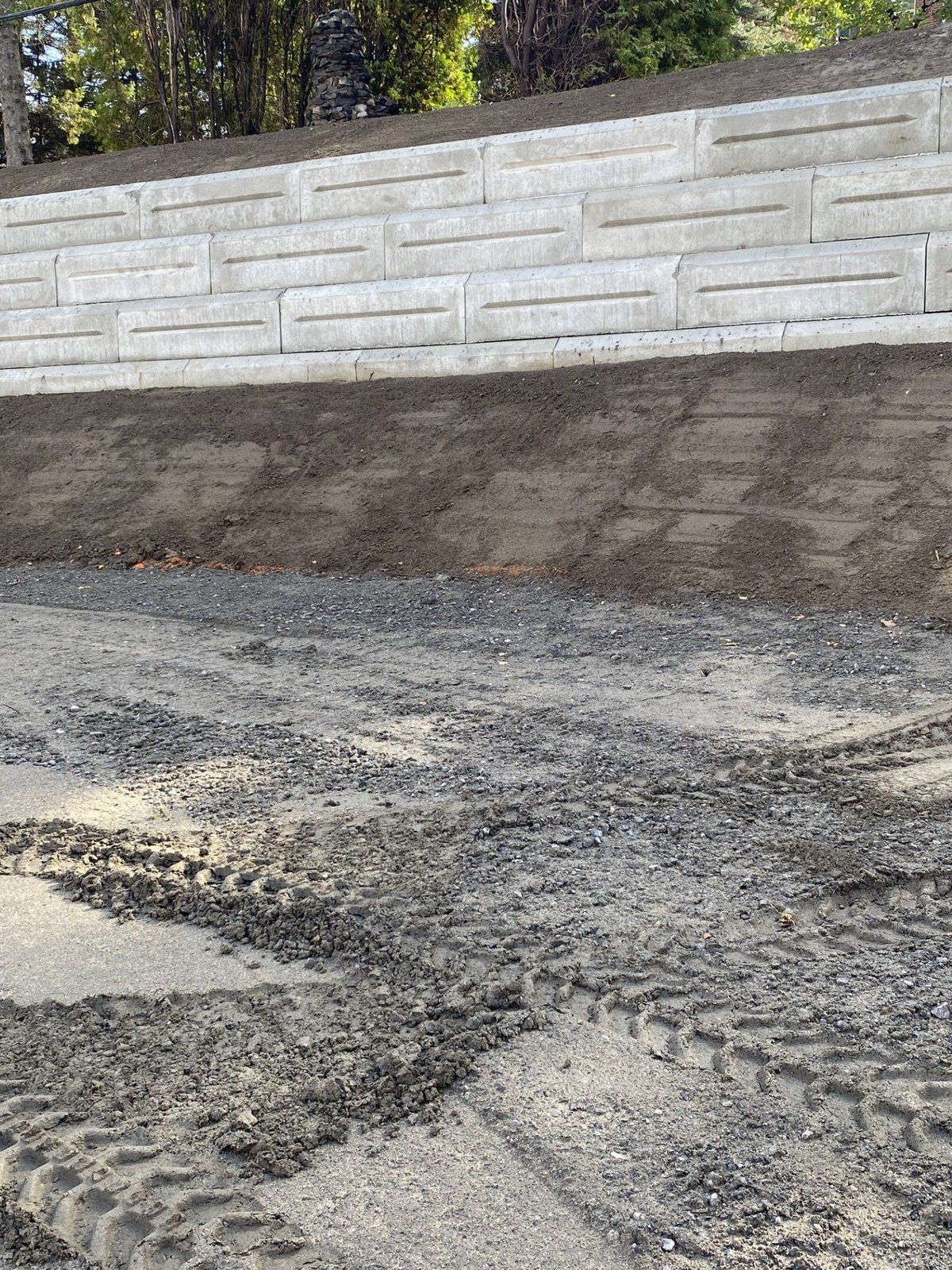
A wharf in Trois-Rivières and a retaining wall in Shawinigan: two walls designed by our engineers. We also carry out many mandates for private individuals in the region, which we do not publish for confidentiality reasons.
New retaining wall
Les Apôtres de l’Amour infini · Shawinigan · October 30, 2025 – October 8, 2026
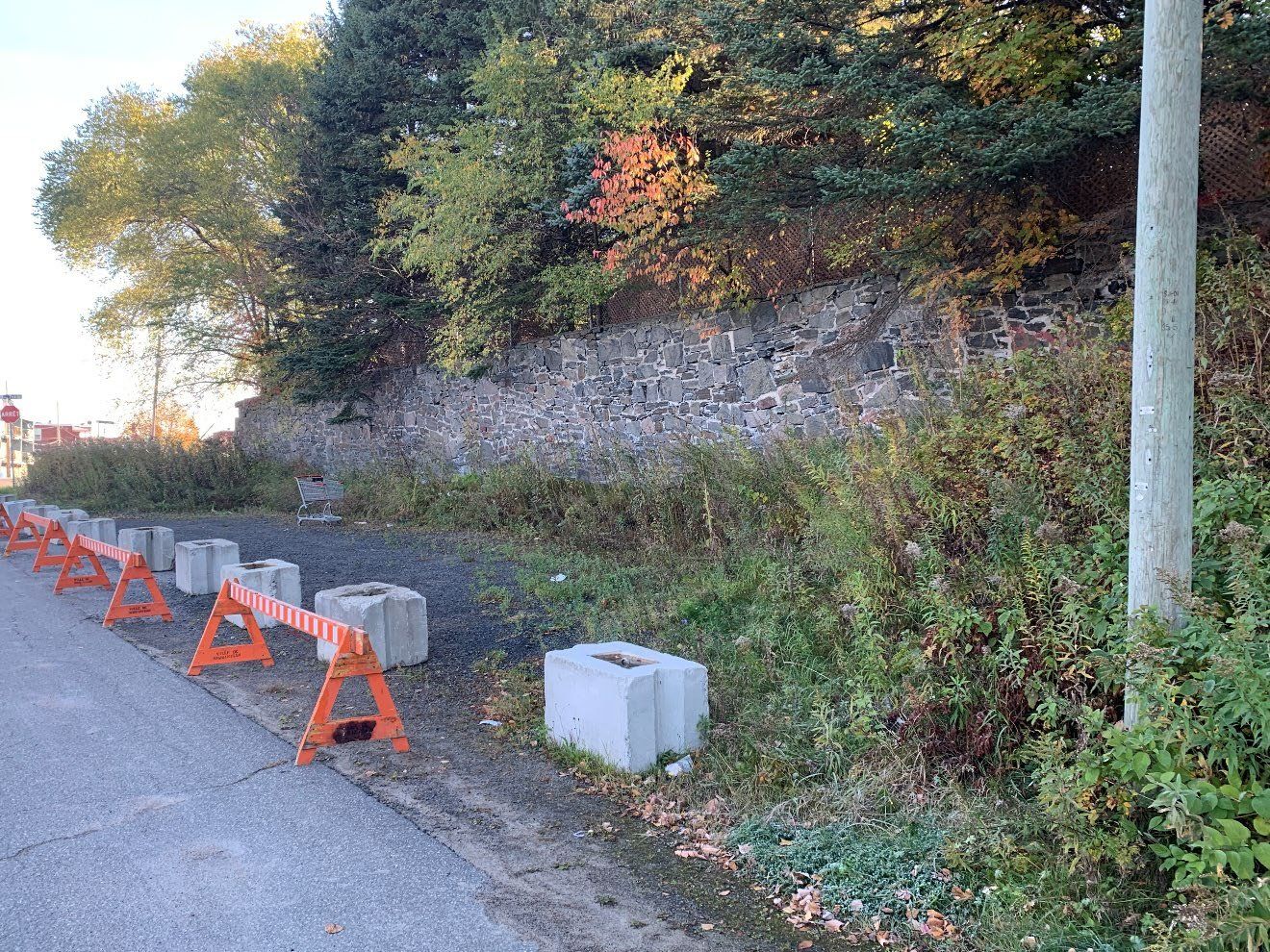
Following a municipal notice on the compliance of the existing site works, a stabilization study was carried out to replace the existing wall, which showed signs of deterioration, with a new, safer wall.
The study includes geotechnical investigations by drilling and test pits, environmental characterization of the soil, the design of the new retaining wall, the preparation of the plans and technical specifications, construction supervision and the issuance of a certificate of compliance.
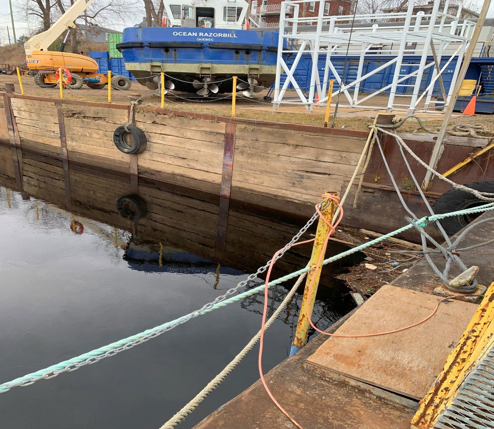
Rehabilitation of the docking wharf for tugboats and barges
Groupe Océan · Trois-Rivières · November 29, 2023 – January 26, 2024
The study covers the design of a new combined wall (sheet piles and steel H-piles) to replace the existing wall: a durable structure suited to the marine environment that meets Groupe Océan’s operational needs while complying with safety and stability standards.
Our services in Mauricie
Soil conditions in Mauricie
North of lac Saint-Pierre, the Champlain Sea left a thick layer of marine clay that forms a vast plain. In Trois-Rivières, from Pointe-du-Lac to Cap-de-la-Madeleine, this clay is covered by thick layers of sand: the sand of the former delta of the rivière Saint-Maurice. Toward Shawinigan, Saint-Boniface and Saint-Étienne-des-Grès, this sand is thinner and rests on fine sediments.
In southwestern Mauricie, the thickness of the unconsolidated deposits ranges from zero, where bedrock outcrops, to 150 m in Trois-Rivières, near the junction of highways 40 and 55. Two neighbouring properties can sit on very different soils: sand, clay or shallow bedrock.
A geotechnical study establishes what is actually beneath your project: the nature of the soil layers, the water level, the bearing capacity of the soil, the expected settlement and the soil liquefaction risk, which is analyzed for every construction project. Learn more about geotechnical studies
Building near a slope in Mauricie
In Quebec, landslides occur mainly in clay soils, along the banks of watercourses, and those that affect clays can reach very large dimensions. On November 9, 2016, in Saint-Luc-de-Vincennes, in the MRC des Chenaux, a landslide in a sensitive clay terrace left a crater about 160 m wide and 177 m long along the rivière Champlain.
Trois-Rivières, Shawinigan and municipalities in the MRC des Chenaux, the MRC de Maskinongé and the MRC de Mékinac are covered by the government mapping of areas potentially exposed to landslides. In these areas, building, extending, filling or excavating near a slope often requires a geotechnical assessment. In Shawinigan, for example, by-law SH-389 requires a permit and, to lift a prohibition, an assessment signed by a geotechnical engineer.
We carry out these assessments: boreholes, stability analysis, design of the stabilization solution, plans and specifications, construction supervision and certificate of compliance. Read our guide to landslides
New foundations after pyrrhotite
In the Trois-Rivières area, many houses were built with concrete whose aggregates contained pyrrhotite. In contact with water and air, this mineral oxidizes: the concrete deforms, swells and cracks. According to the Institut national de santé publique du Québec, these aggregates were used in the 1990s, and uncertified aggregates were reportedly used until the end of 2008. The Coalition d’aide aux victimes de la pyrrhotite reports thousands of affected houses in Mauricie.
Diagnosing the concrete is a matter for concrete and structural specialists. Our role comes next, before the new foundations are designed: boreholes or excavations to establish the foundation level and the bearing capacity of the soil. The dimensions and reinforcement of the new foundations depend on them.
Our prices
Indicative prices, the same as elsewhere in Quebec. Travel fees are added depending on the mandate. The exact price is given in the quote, once the project, the site and access to it are known.
| Type of study | Indicative price |
|---|---|
| Soil bearing capacity for a house or cottage | $4,500 to $7,500 |
| Ground or slope stability check | $3,000 to $7,000 |
| Advanced seismic analysis (soil liquefaction risk) | From $8,000 |
| Commercial or industrial building, street, municipal structure, dam | By quote |
Frequently asked questions
Do you work in Trois-Rivières and the Mauricie region?
Yes, as we do everywhere in Quebec. Among other projects, we designed the new combined wall of Groupe Océan’s docking wharf in Trois-Rivières and, in Shawinigan, the wall that replaced a deteriorated retaining wall, from the boreholes to the certificate of compliance. We also carry out many mandates for private individuals in the region, which we do not publish for confidentiality reasons.
Do you need a geotechnical assessment to build near a slope in Shawinigan?
Most of the time, yes. In landslide constraint zones, Shawinigan’s interim control by-law SH-389 requires a permit or a certificate of authorization for the interventions it covers. An otherwise prohibited intervention may be permitted if a geotechnical assessment, prepared by a geotechnical engineer who is a member of the Ordre des ingénieurs du Québec, justifies it. After stabilization work, the engineer issues a certificate of compliance; the premises cannot be occupied until the City has received it.
What about Trois-Rivières or the neighbouring regional county municipalities (RCMs)?
Trois-Rivières and municipalities in the MRC des Chenaux, the MRC de Maskinongé and the MRC de Mékinac are covered by the government mapping of areas potentially exposed to landslides. The applicable rules depend on the municipality: check with its urban planning department whether your property is in a constraint zone.
Do you carry out pyrrhotite assessments?
Diagnosing concrete affected by pyrrhotite is a matter for concrete and structural specialists. We step in before the new foundations are designed: boreholes or excavations to establish the foundation level and the bearing capacity of the soil.
How much does a geotechnical study cost?
Our prices are the same as elsewhere in Quebec: $4,500 to $7,500 for the soil bearing capacity of a house or cottage, $3,000 to $7,000 for a ground or slope stability check, and from $8,000 for an advanced seismic analysis. Travel fees are added depending on the mandate. The exact price, which depends on the project, the site and access to it, is given in the quote.
Further reading
All our guidesSources
- Y. Leblanc et al., Caractérisation hydrogéologique du sud-ouest de la Mauricie, Université du Québec à Trois-Rivières, 2013: environnement.gouv.qc.ca.
- Ministère des Affaires municipales et de l’Habitation, municipalities covered by the mapping of areas potentially exposed to landslides, 2024: cdn-contenu.quebec.ca.
- Government of Quebec, Glissements de terrain dans les dépôts meubles : types et causes, 2017: cdn-contenu.quebec.ca.
- Ville de Shawinigan, interim control by-law SH-389, up-to-date administrative version of by-law SH-389.5, in force since November 18, 2025: shawinigan.ca.
- F. Tremblay-Auger et al., “The 2016 landslide at Saint-Luc-de-Vincennes,” GeoEdmonton 2018: cgs.ca.
- Institut national de santé publique du Québec, Risques sanitaires potentiels associés aux altérations des fondations de bâtiments par la pyrrhotite, 2014: inspq.qc.ca.
- Coalition d’aide aux victimes de la pyrrhotite, Guide relatif aux étapes des travaux de réfection des fondations affectées par la pyrrhotite, 2024: cavp.info.